America's Best Nothing Exits
We've spent two weeks mapping emptiness: food deserts, fuel deserts, the 2,957 exits with almost nothing at all. Then a commenter on our Roads That Remember thread pushed back with the best correction yet: some of those "empty" exits are the whole reason for the trip. Crescent Junction scores a 1 in our database. It's also the front door to Arches and Canyonlands. The exit for Goblin Valley scores a zero. You cannot buy a hamburger there because the land is too busy being magnificent.
Point taken. So we went through every empty-tier exit in the country and picked the ten with the least at the ramp and the most behind it.
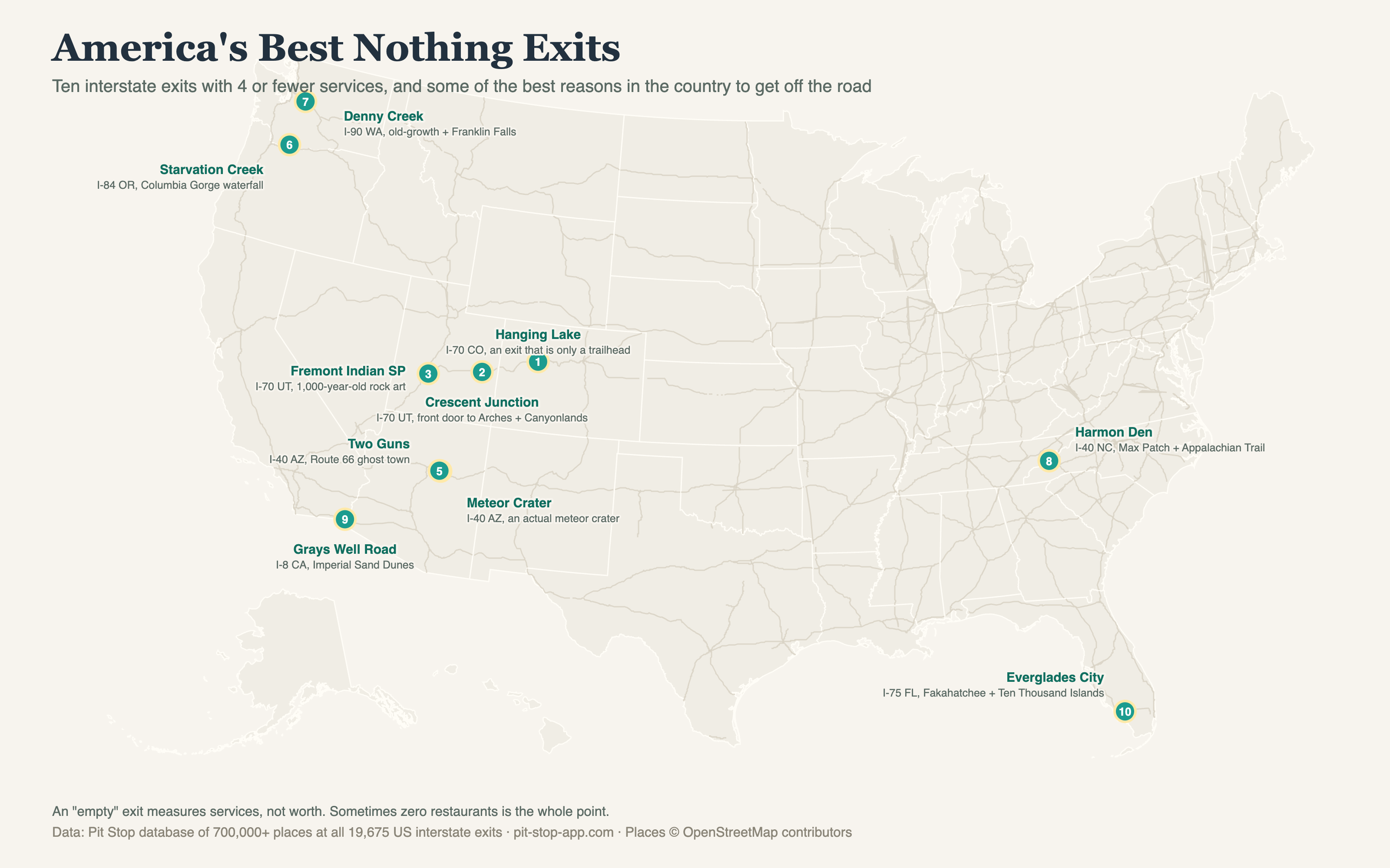
Empty means 4 or fewer traveler-relevant places within a mile of the ramp.
The list
| # | Exit | Places | What's actually there |
|---|---|---|---|
| 1 | I-70 exit 125, Hanging Lake, CO | 0 | An exit that exists only for a trailhead. Park in Glenwood Canyon, climb a mile, find a turquoise lake hanging off a cliff. Permit required now, because everyone found out. |
| 2 | I-70 exit 182, Crescent Junction, UT | 1 | The reddit comment that caused this post. Nothing at the ramp; Arches, Canyonlands, and Moab down the road. The most valuable 1-place exit in America. |
| 3 | I-70 exit 17, Fremont Indian State Park, UT | 1 | They found the largest known Fremont village while building this stretch of I-70. The rock art is a thousand years old and it's right at the ramp. |
| 4 | I-40 exit 233, Meteor Crater Road, AZ | 4 | A 550-foot-deep hole punched by a meteor 50,000 years ago. Astronauts trained in it. Four places at the exit, one giant crater six miles south. |
| 5 | I-40 exit 230, Two Guns, AZ | 2 | A Route 66 ghost town on the rim of Canyon Diablo, ruins and all. The old zoo cage still says MOUNTAIN LIONS. Nothing is open. That's the point. |
| 6 | I-84 exit 55, Starvation Creek, OR | 1 | A Columbia River Gorge waterfall with the best worst name in the system, from a train that got snowed in here in 1884. Nobody actually starved. The falls are a five minute walk. |
| 7 | I-90 exit 47, Denny Creek, WA | 0 | Old-growth forest, a waterslide of a creek over granite, and Franklin Falls, where the waterfall is practically under the freeway viaduct. Zero services, endless trailheads. |
| 8 | I-40 exit 7, Harmon Den, NC | 2 | A dirt-road exit in Pisgah National Forest that hikers know as the way to Max Patch, the great grassy bald of the Appalachian Trail. The East's emptiest-best exit. |
| 9 | I-8 exit 156, Grays Well Road, CA | 0 | The Imperial Sand Dunes, 40 miles of Sahara that Hollywood uses when it needs another planet, plus the remains of the 1915 wooden plank road that crossed it first. |
| 10 | I-75 exit 80, Everglades City, FL | 1 | Off Alligator Alley into Fakahatchee Strand, the orchid and panther swamp, and on to the Ten Thousand Islands. One place at the ramp, one Everglades behind it. |
What this list is really about
Our whole "empty exit" franchise measures one thing: whether a driver can get food, fuel, or a bed. That's the right measure at 75 mph with a gas light on. But it was never a measure of whether an exit matters. Most of these ramps exist because there's nothing to build: Hanging Lake and Denny Creek sit in protected canyons, Grays Well in federal recreation land, Crescent Junction at the edge of country the BLM will never let become an outlet mall. The commenter who inspired this had it exactly right: the land is spoken for, and what it's spoken for is the reason you'd stop.
So consider this the other half of the Interstate at Night map. The dark exits aren't all dead. A few of them are the brightest stops on the whole road, as long as you brought your own sandwich.