Running on Empty: Where America's Interstates Go Longest Without Gas
Every region has its famous warning sign. NO SERVICES NEXT 100 MILES. Locals know exactly which exit is the last one; visitors find out at three-quarters of a tank. We measured every one of them.
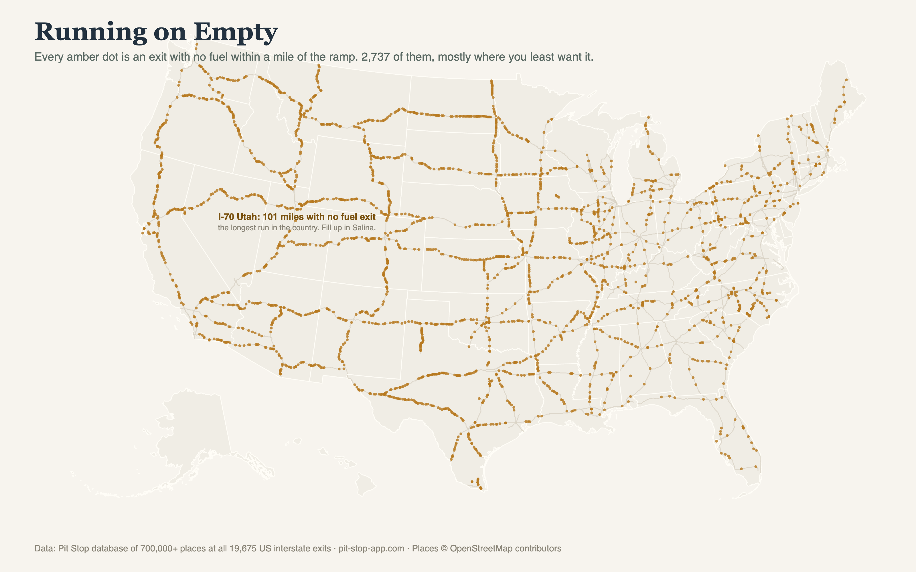
Between Salina and Green River, across the San Rafael Swell, the exits lead to rock, sky, and zero pumps. It's the same stretch that holds the national food-gap record — the most nothing per mile in the interstate system.
The last exits before nothing
Salina, Utah (I-70, milepost 56) is the most consequential small town in American road-tripping: the final fuel for over a hundred miles, a fact the town's gas stations commemorate with signage and prices to match. Its counterparts run the map — the I-77 stretch through the West Virginia mountains posts a 73-mile fuel gap between exits, and long runs of I-94 in western Wisconsin and I-74 in the Carolinas crack the top of the list by our count.
The turnpike asterisk
Some of the biggest "gaps" in raw exit data are actually a design choice: turnpikes. The West Virginia Turnpike section of I-77, the Pennsylvania Turnpike, Florida's Turnpike — these roads deliberately have few exits and put fuel on the highway at service plazas instead. Pit Stop maps all 1,529 rest areas and service plazas at their true mile markers for exactly this reason: on a turnpike, the plaza is the exit.
Why we obsess over this
The blue signs at any single exit tell you about that exit. Nothing on the road tells you the next fuel is 101 miles away. That gap between what the road tells you and what the road is about to do to you is the entire reason Pit Stop exists: the app shows every exit ahead, including the moment when "every exit ahead" means none for a hundred miles. Fill up in Salina. We mean it.