The Interstate at Night: How Much Is Really at America's Exits
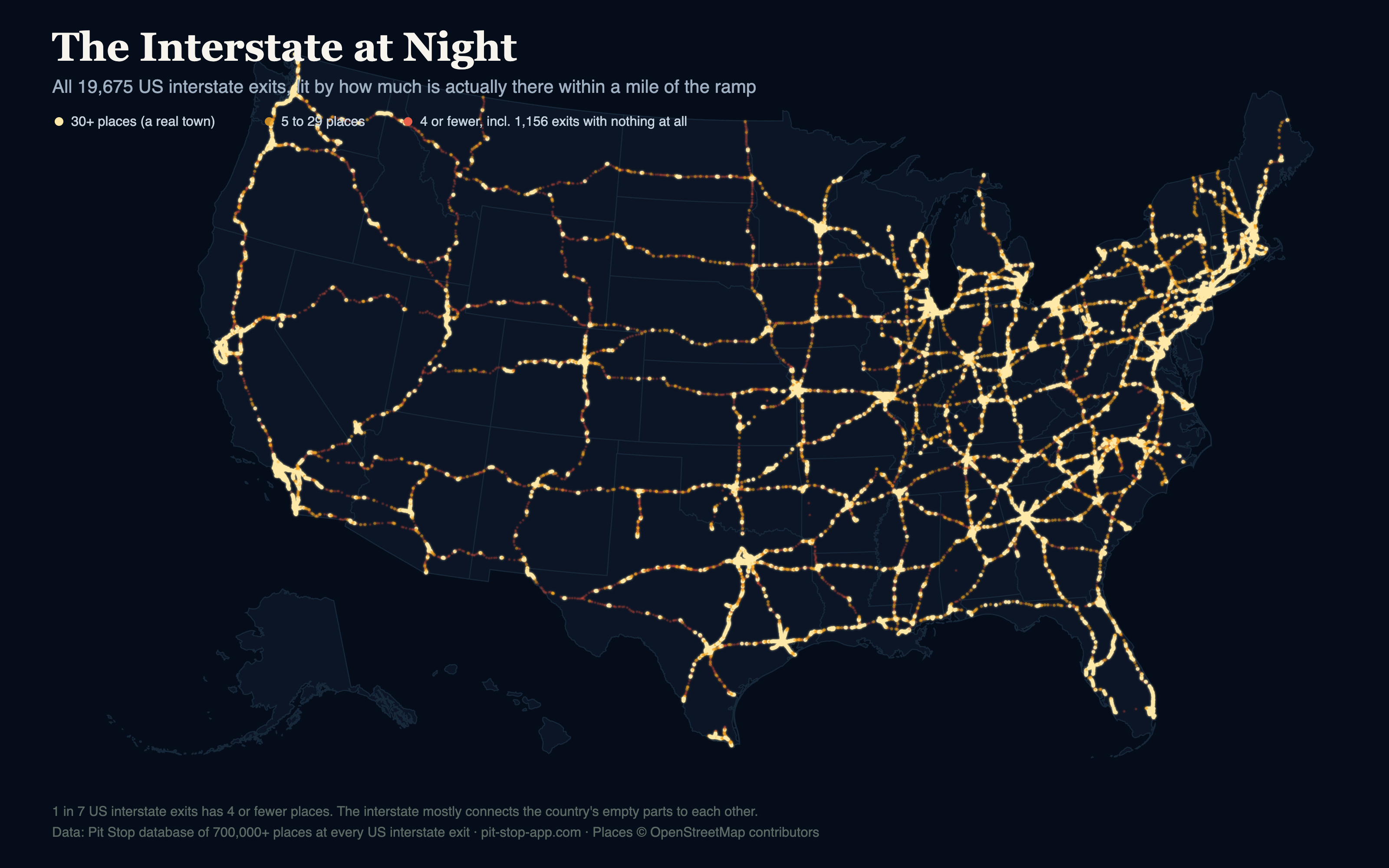
In a thread about our playground map, a commenter asked a fair question: wouldn't most exits serve a community? Why would an exit exist if a town isn't nearby? It's a good intuition, and it deserved a real answer. So we lit up every exit in America by how much is actually there.
Not a gas station. Not a diner. An off-ramp, a stop sign, and a county road going somewhere you've never heard of.
So who's right?
Mostly, the intuition holds: exits follow people. The gold in the map is the proof — dense strings of well-stocked exits through every metro and along the town-rich eastern corridors. The median exit has around 40 traveler-relevant places within a mile. The interstate is, most of the time, a main street that happens to move at 75 mph.
But the red is real too. Nearly 3,000 exits serve almost nobody. They exist because a ranch needed access, because a farm road crossed the alignment in 1963, because two interstates had to meet somewhere. Whole corridors of the Mountain West and West Texas run on these — the same voids that hold our restaurant gap records and playground deserts. The interstate doesn't just connect America's towns. It spends a surprising share of its miles connecting the country's empty parts to each other.
Reading the map
Bright gold exits have 30+ places — a real town. Amber is the in-between: a cluster of gas stations, a motel, maybe a Subway. The ember-red dots are the 4-or-fewer exits, and long red runs are the stretches where you fill the tank when you can, not when you want. I-90 and I-94 across the northern plains, I-10 and I-20 through West Texas, most of Nevada and Wyoming: whole hours of driving lit only by embers.
The honest fine print
Our database counts traveler-relevant places (food, gas, hotels, attractions, rest stops, playgrounds), so an "empty" exit might still have houses or a grain elevator nearby — it's empty for a driver, which is the measure that matters at 75 mph. And listings are capped per exit in the app, so the bright end of the scale is even brighter in reality than we can show.