Every Interstate Exit With a Playground Within a Mile
Every parent knows the math of a long drive: somewhere around hour three, someone under four feet tall needs to run in a circle for fifteen minutes or the whole car pays for it. The problem is you can't see a playground from the interstate. So we mapped them.
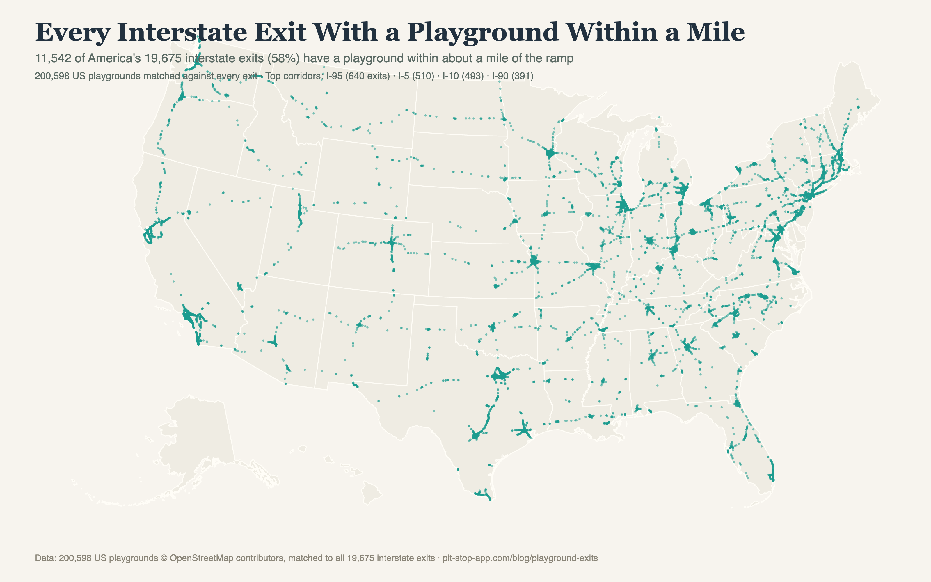
That's 200,598 US playgrounds matched against every exit in the country. More than half the time, the swing set was right there.
The corridors that carry kids
I-95 is America's playground corridor with 640 exits, which tracks: it threads through more towns than any other road. Then I-5 (510), I-10 (493), I-90 (391), I-80 (371), and I-70 (363). Texas and California essentially tie for the state lead at about 1,200 exits each.
The playground deserts
A reader asked the obvious inverse: where are the exits without one? The emptiest stretch in America is — who else — I-10 through West Texas: 210 miles between playground exits (milepost 155 to 365), the same void that holds most of the restaurant-chain gap records. The runners-up: I-10 across the Florida panhandle (153 miles), I-5 through California's Central Valley (151), and I-40 through the Mojave (139). Those are the four drives where you let the kids run laps around a gas pump and apologize.
How to actually use this
The trick to the playground stop is pairing it: gas up, grab food, then ten minutes of swings before buckling back in — it converts a 15-minute stop into a reset that buys you two quiet hours. The dark stretches on the map (rural I-90, I-94, the Mountain West) are where you plan ahead, because the exits out there are 30 miles apart and most have nothing but a gas pump.
Update: as of this week, the playgrounds are in the app. Every playground on this map now shows up on its exit's page in Pit Stop, alongside the gas, food, and hotels — so the "is there a playground at this exit" question answers itself while you're driving.
The honest fine print
A playground within a mile of the ramp is not always a playground you'd detour for — some are school playgrounds (often off-limits during school hours), some are a single sad spring horse. OpenStreetMap coverage also under-counts in rural areas, so the real number is, if anything, higher than 58%.