The Waffle House Line: The Exact Northern Border of Waffle House America
People argue about where the South begins. The Mason-Dixon Line is a surveyor's abstraction, sweet tea availability is anecdotal, and college football loyalty maps are contested territory. But there is one border you can actually drive across, and the moment you cross it, you know: the last Waffle House.
We mapped every business at every interstate exit in America for the Pit Stop app, so we drew the line properly.
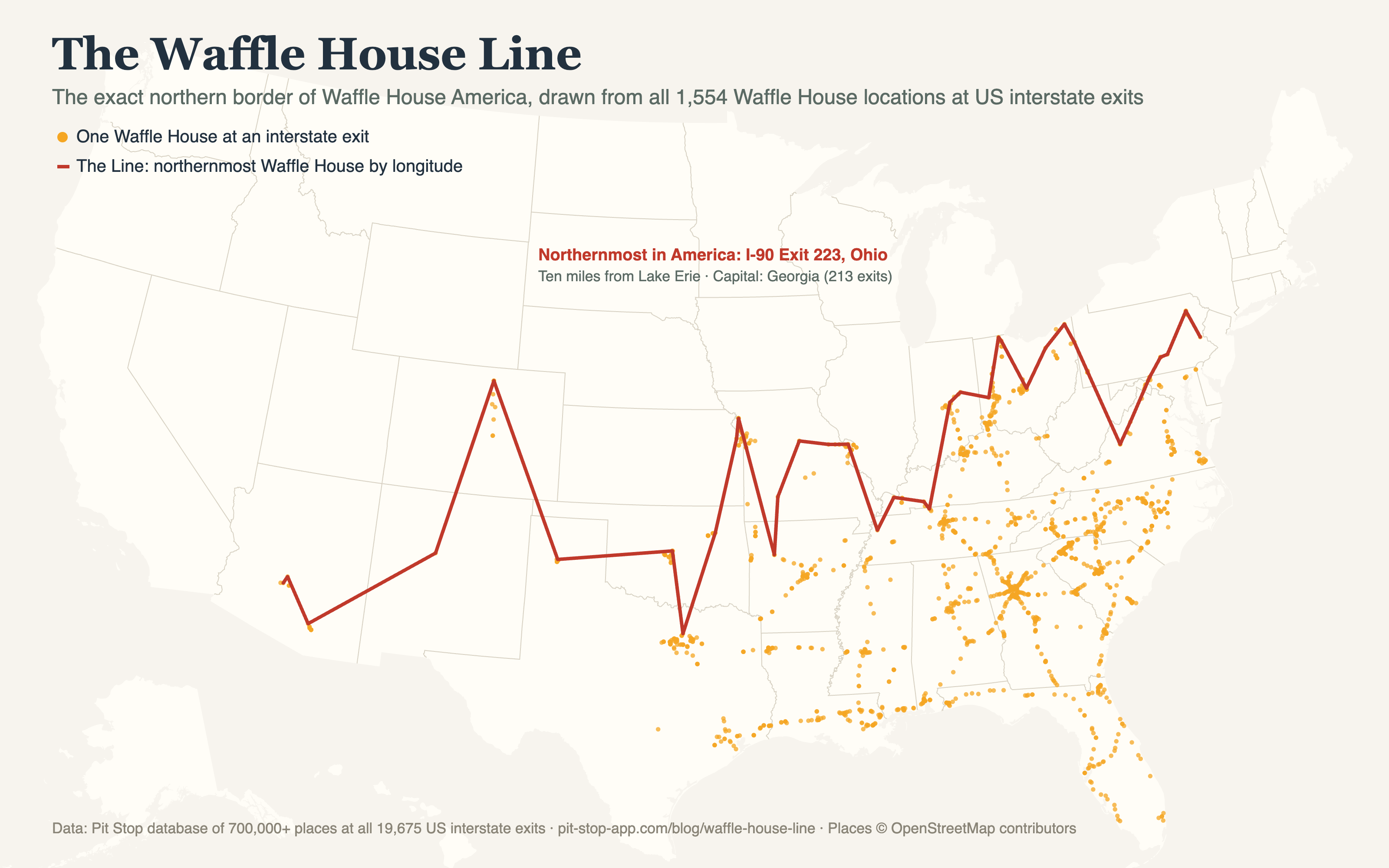
The Waffle House Line. Click for full resolution.
That's Ashtabula County, ten miles from Lake Erie. You can stand in the northernmost interstate Waffle House in the country and practically feel Canada disapproving of your hash browns.
The Line, highway by highway
Drive south on any north-south interstate and somewhere, at one specific exit, Waffle House America begins. These are the actual border crossings:
| Interstate | The first Waffle House exit | Latitude |
|---|---|---|
| I-75 | Exit 193, Ohio (Lima) | 41.55° |
| I-81 | Exit 194, Pennsylvania | 41.49° |
| I-71 | Exit 218, Ohio | 41.14° |
| I-77 | Exit 120, Ohio | 40.99° |
| I-25 | Exit 269B, Colorado | 40.58° |
| I-65 | Exit 103, Indiana | 39.67° |
| I-95 | Exit 109B, Maryland | 39.64° |
| I-55 | Exit 11, Illinois | 38.68° |
The Line is not straight. It bulges north through Ohio (three interstates cross it above the 41st parallel there, making Ohio the contested frontier of Waffle House America), sags in the Midwest, and on I-95 the border of the South is, of all places, Maryland — which Marylanders will consider either obvious or fighting words.
The heartland and the frontier
The capital is not in question: Georgia has Waffle House at 213 interstate exits, nearly one in three of the state's exits, with South Carolina and North Carolina tied at 149. The western frontier is I-10 Exit 129 in Arizona, west of Phoenix — beyond it, scattered along a thousand miles to the Pacific, there is nothing.
The other Southern constant
While we had the ruler out, we measured the South's other roadside institution. On I-40 through Tennessee, home of the most Cracker Barrel-dense driving in America, you are never more than 90 miles from a Cracker Barrel, and usually much closer: 17 exits across the state. The inverse record belongs to West Texas, where I-10 runs 473 miles between Cracker Barrels, from El Paso's outskirts to the Hill Country. That's the longest rocking-chair-free stretch of interstate in the nation. Pack accordingly.