America's Most Haunted Highways: We Mapped All 4,644 Cemeteries Visible From the Interstate
Here's something you've never counted on a road trip, even though it's been out the window the whole time: cemeteries. The American interstate system was carved through two centuries of settled country, and the graveyards of every town it passed, bypassed, or paved around are still sitting there beside the roadway — family plots behind fence lines, church cemeteries on hillsides, memorial parks facing six lanes of traffic.
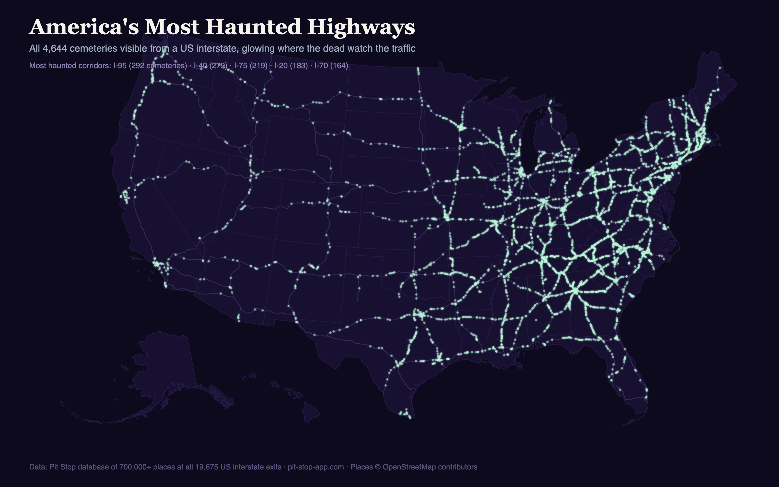
We mapped every one of them. Not out of morbid curiosity — out of a kids' game, which we'll get to. First, the numbers.
That's roughly one every ten miles of interstate driving, coast to coast. On the average family road trip, you pass a graveyard about every nine minutes and almost never notice.
The most haunted highway in America
By total count, the champion is I-40, the great southern cross-country route from North Carolina to California: 279 cemeteries along its length, with its Tennessee and North Carolina stretches ranking #1 and #2 among every individual state-highway segment in the country. Busy, coastal I-95 — which threads through more old towns than any road in America — actually passes the most in raw total per highway family, at 292, but spreads them across fifteen states.
| Highway | Cemeteries visible |
|---|---|
| I-95 (Maine to Florida) | 292 |
| I-40 (North Carolina to California) | 279 |
| I-75 (Michigan to Florida) | 219 |
| I-20 (Texas to South Carolina) | 183 |
| I-70 (Maryland to Utah) | 164 |
Single most haunted stretch of road in the country, by state segment:
| Segment | Cemeteries | Rate |
|---|---|---|
| I-40, Tennessee | 104 | one every 4.3 miles |
| I-40, North Carolina | 96 | one every 4.3 miles |
| I-75, Georgia | 85 | one every 4.1 miles |
| I-24, Tennessee | 69 | one every 3.1 miles |
| I-81, Virginia | 61 | one every 5.3 miles |
The most haunted ten miles in America
The record for density belongs to I-26 in East Tennessee, where the highway climbs out of Johnson City into the Appalachians toward Erwin. Between mile markers 17 and 27 the road passes 15 cemeteries in under ten miles — Washington County Memory Gardens, Shipley, Krouse, Peoples, Longmire, Hoss, Simerly, Buffalo Valley, and half a dozen more, one after another. This is old settled mountain country, where every hollow had a family and every family had a plot, and the interstate threaded right between them. Across its full Tennessee run, I-26 passes a cemetery every 1.3 miles — the highest sustained rate of any interstate segment in the country.
The South buries deepest
By state, the ranking is a map of America's oldest continuously settled countryside:
| State | Interstate-visible cemeteries |
|---|---|
| Tennessee | 356 |
| North Carolina | 303 |
| Georgia | 300 |
| Pennsylvania | 254 |
| Texas | 220 |
Tennessee's lead isn't close, and it's structural: three of the ten most cemetery-lined highway segments in America (I-40, I-24, and I-26) run through it. The Appalachian corridor states — Tennessee, the Carolinas, Virginia, Pennsylvania — dominate because the interstates there follow valley routes that people have been living and dying along since the 1700s.
At the other extreme: I-8 across the Southern California desert runs about 170 miles without passing a single one — the longest cemetery-free interstate drive in the country. Nobody settled it, so nobody's buried there.
Why on earth we counted this
Because of a cow game. There's a road trip game American families have played for generations: count cows out your window — and if you pass a cemetery, your cows die. When we asked parents on Reddit for their family's road trip games, four different families independently taught us the same cemetery rule, unprompted, in one evening.
So we built it. Pit Stop's Backseat Games now include Cow Collector: passengers claim the cows they spot from their own phones, and when the car genuinely passes one of these 4,644 cemeteries, every phone in the car buzzes with the cemetery's actual name and a burial window opens — the first player to tap the coffin wipes every other herd back to zero. The cemetery data is real specifically so nobody's little brother can fake one. On that stretch of I-26, no herd survives.
4,065 of the 4,644 have recorded names, which means the game announces burials the way the data deserves: not "a cemetery," but Buffalo Valley Cemetery, Earthman Resthaven, or the Independent Order of Odd Fellows Cemetery, of which America's interstates pass several.