The Long Golden Hour: Highway 1, Rebuilt From the Water
Every photo you've ever loved of Highway 1 was taken from the same place: offshore, at sunset, looking back at the road clinging to the cliffs. The postcard view. The one you can't actually have while you're driving it, because you're on the road, not out on the water.
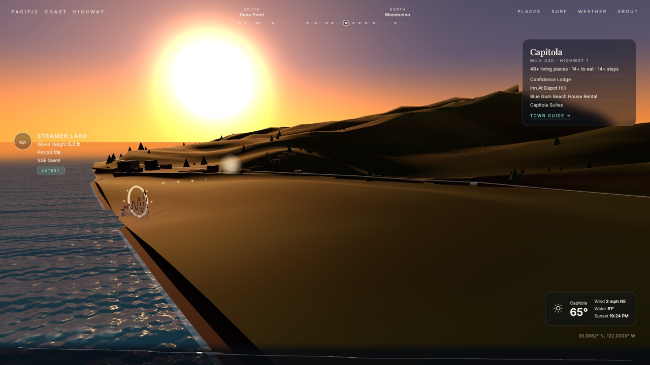
So we built the view. All 694 miles of California's Highway 1 — Dana Point to the Lost Coast — rebuilt in 3D from real elevation data, seen from a boat that keeps pace with you offshore, at a golden hour that never ends. Scroll and you drive. Take the drive →
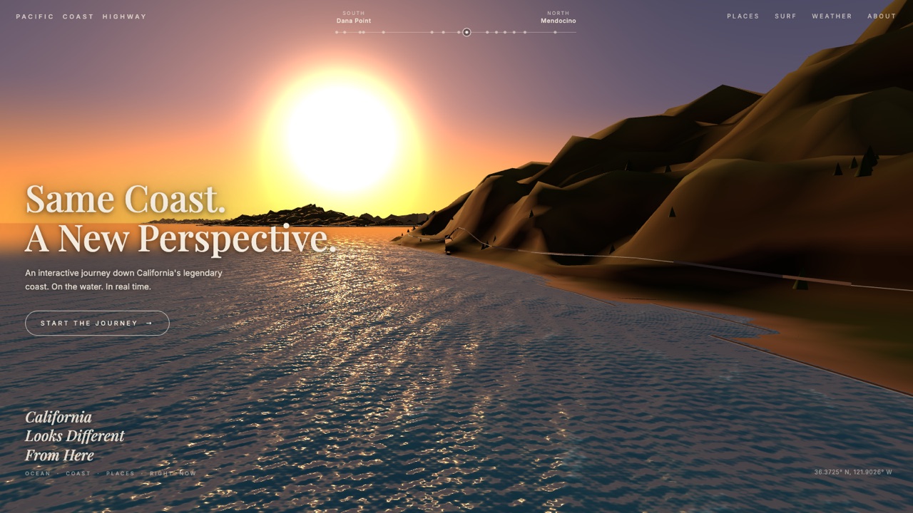
The only fiction is the clock: it's always 40 minutes before sunset.
What "real" means here
The terrain is the actual coast. We sampled more than 10,000 points of USGS 10-meter elevation data in a strip from a mile offshore to six miles inland, along the full route. Big Sur's cliffs, the Guadalupe dunes, the Marin headlands, the flat Salinas Valley mouth at Moss Landing — they rise and fall where they really do. (One honest disclosure: heights are drawn at 4× vertical exaggeration, the standard trick in coastal relief maps. Without it, from the water, even Big Sur reads as a gentle hill.)
The ocean is today's ocean. Nine NOAA buoys along the coast — Trestles to Point Arena, covering ten surf breaks — report live wave height, period, and swell direction as you pass. The weather chip is the real current temperature and wind for whatever town you're passing, and the swell size in the water actually follows the buoy data.
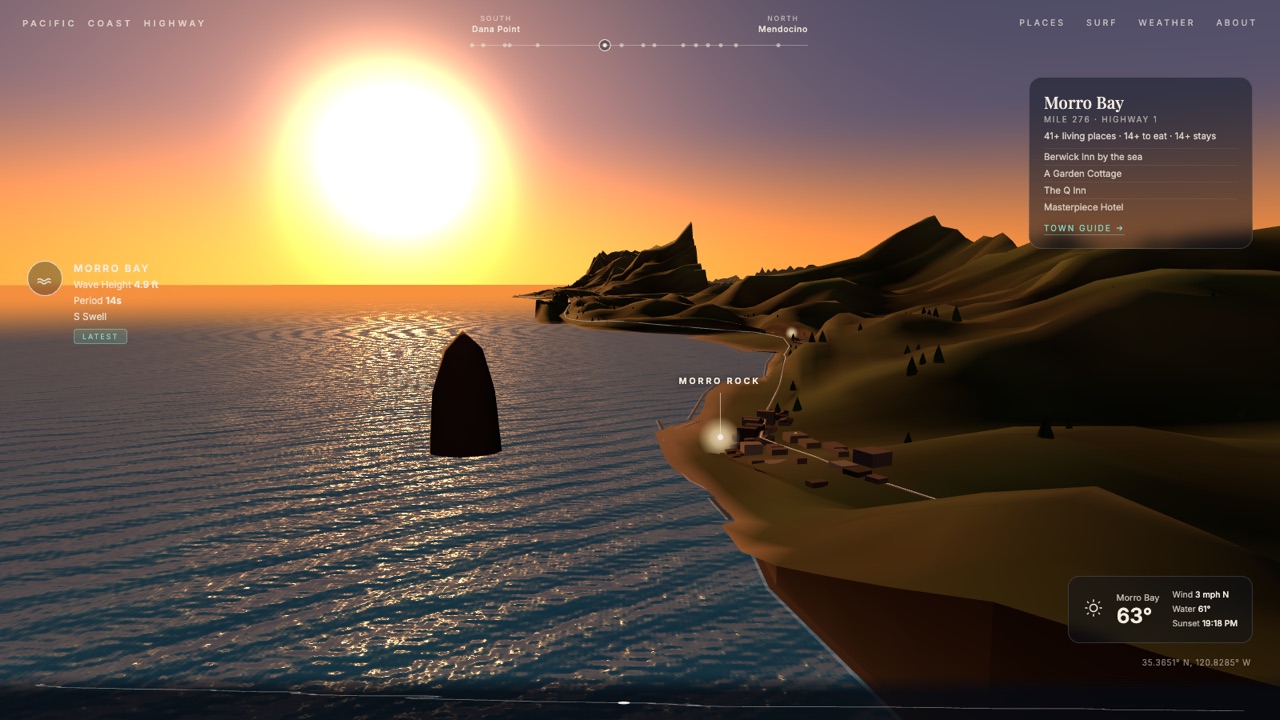
The towns are the real towns. Every glowing cluster of lights is one of the 118 communities on the highway, sized by how much is genuinely there, drawn from the same database that powers our Highway 1 exit guides. Pass Morro Bay and its card shows you the real inns on the Embarcadero. Pass Capitola and it's the real lodges above the real beach.
The landmarks are where they belong
Locals will look for their spots, so we put them there, at their true coordinates: Morro Rock standing in the harbor mouth. The Bixby Creek arch. Point Sur's whale-back hump with the light station on top. Hearst Castle glowing on its hill above San Simeon. The Giant Dipper's white lattice and the lit ferris wheel at the Santa Cruz Beach Boardwalk. Pigeon Point and Point Arena lighthouses with their lamps on. The piers at Santa Cruz, Huntington, and Santa Monica, strung with lights, with the Pacific Wheel glowing at the end of the last one.
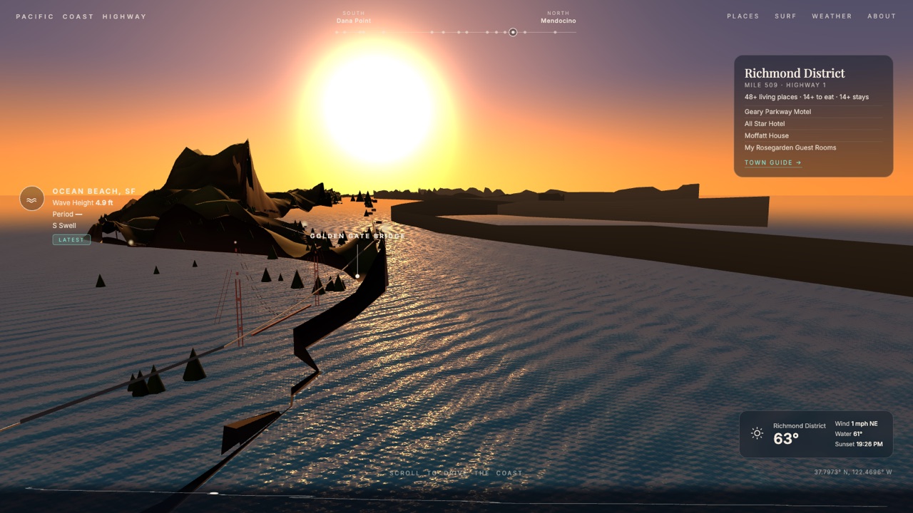
And at mile 513, the road does what the real one does: it crosses the Golden Gate, deck, towers, catenary cables and all, with the strait actually under it.
Why we built it
Pit Stop's whole thing is knowing what's at the exit before you get there. The Highway 1 guides already cover the road mile by mile. But some roads deserve more than a listing — they deserve the feeling. We did this once before with our Route 66 centennial flyover, and people drove it end to end, so this is the second in the series: the two greatest American road trips, one from the air, one from the water.
It runs in your browser, no app needed. Scroll, or use arrow keys. It works on your phone. The full drive takes about ten minutes if you don't stop, but the whole point is stopping.