The Entire Buc-ee's Interstate Empire, on One Map
No gas station in America has a fandom like Buc-ee's. People plan routes around it, buy the shirts, and argue about brisket at 9 in the morning. So here is the whole empire on one map: every Buc-ee's at a US interstate exit.
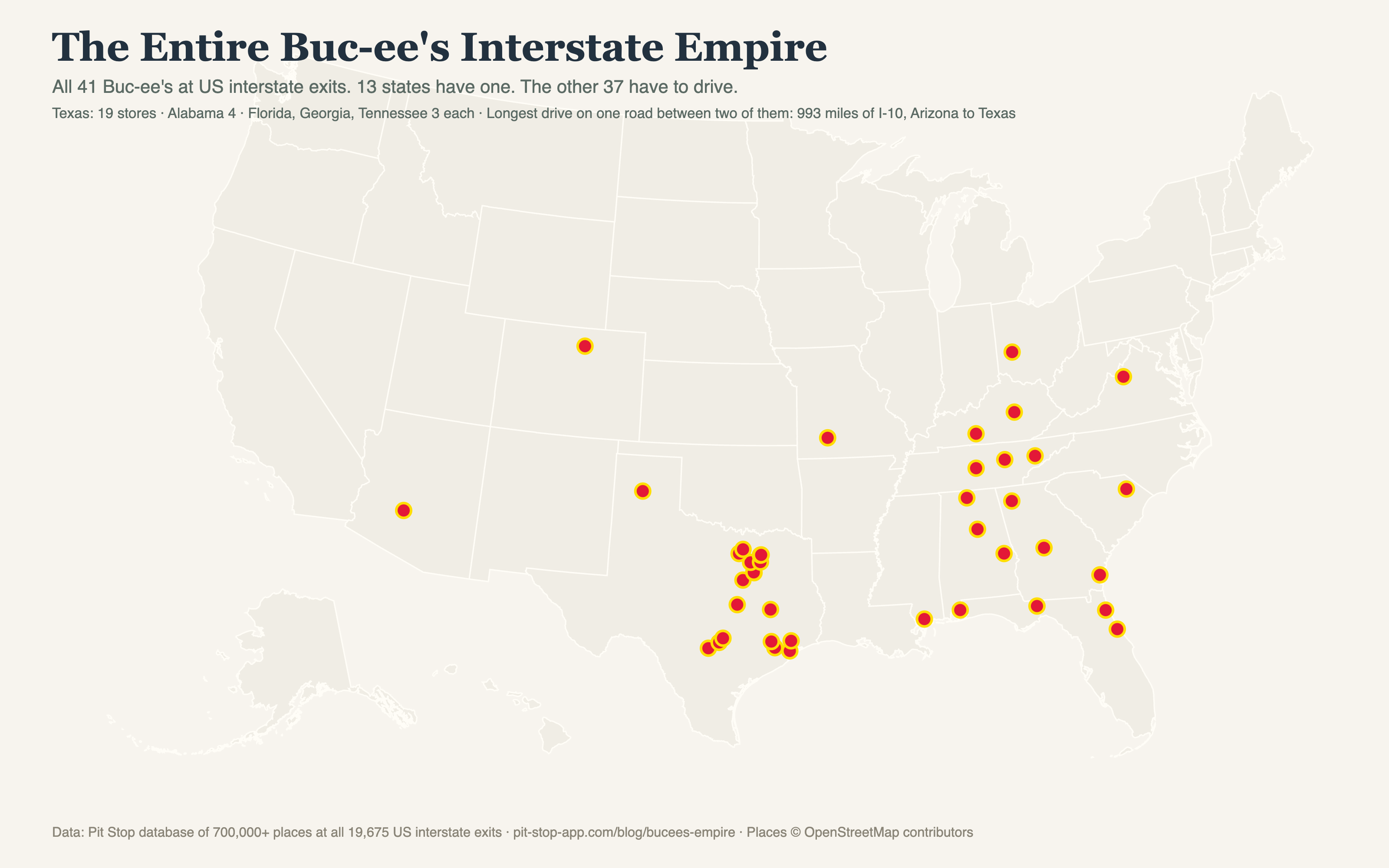
Texas holds 19 — nearly half the empire — then Alabama with 4, and Florida, Georgia, and Tennessee with 3 each.
The great Buc-ee's void
The map has two lobes — the Texas homeland and the southeastern expansion — plus lonely outposts in Arizona, Colorado, Missouri, Ohio, and Virginia. Between them: nothing. The longest single-road drive between two Buc-ee's is 993 miles of I-10, from the Phoenix-area store to the first one in central Texas. Cross the entire Mountain West, the Plains, the Northeast, or the Pacific coast and you will not see the beaver once.
Where the walls are (for now)
The northern frontier runs through Richmond (KY), Huber Heights (OH), and Mount Crawford (VA). The western wall is the lone Arizona store and Johnstown, Colorado. Every announced expansion pushes these walls outward a store at a time, which is exactly why the fandom treats new openings like sports franchises coming to town.
The empire is thin on purpose
McDonald's covers 4,292 interstate exits. Buc-ee's covers 41 and is arguably more famous for it. The scarcity is the product: a Buc-ee's is a destination precisely because your state probably doesn't have one, and the 166-mile gap between the two Georgia stores on I-75 is the closest thing the brand has to saturation.